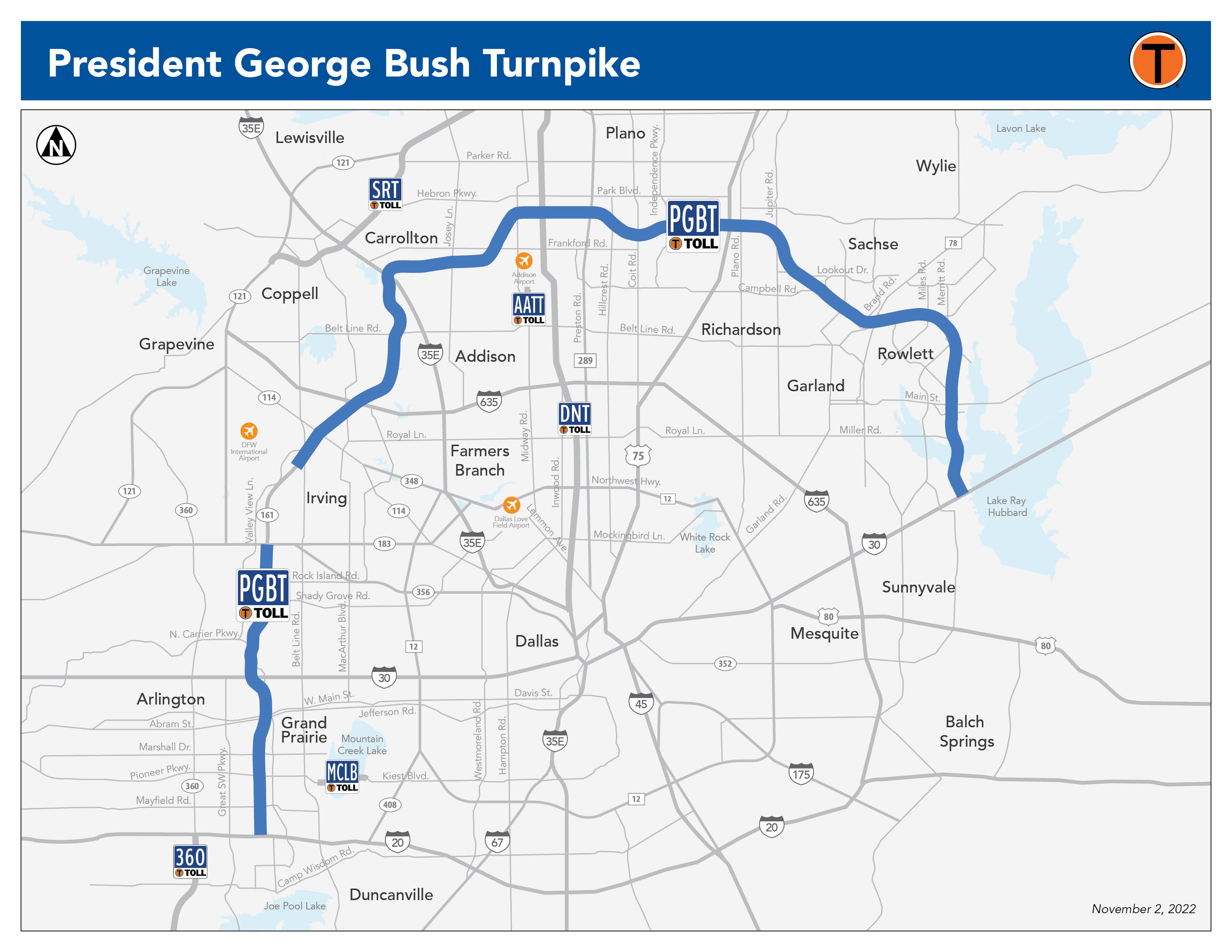
President George Bush Turnpike (PGBT)
The President George Bush Turnpike forms a sweeping arch across the eastern half of the Metroplex, connecting drivers with communities in Collin, Dallas, Denton and Tarrant counties. The 52-mile toll road has expanded significantly since the first section opened in 1998 between Midway Road and Preston Road. By 2005, the PGBT ran between Beltline Road in Irving and SH 78 in Garland.
The mainlanes of the PGBT between SH 183 and I-30 opened to traffic in 2009. SH 78 to I-30 opened in 2011. The section between I-30 and I-20 in Grand Prairie opened in 2012. The road was expanded during projects from 2016-2022.

Map of President George Bush Turnpike
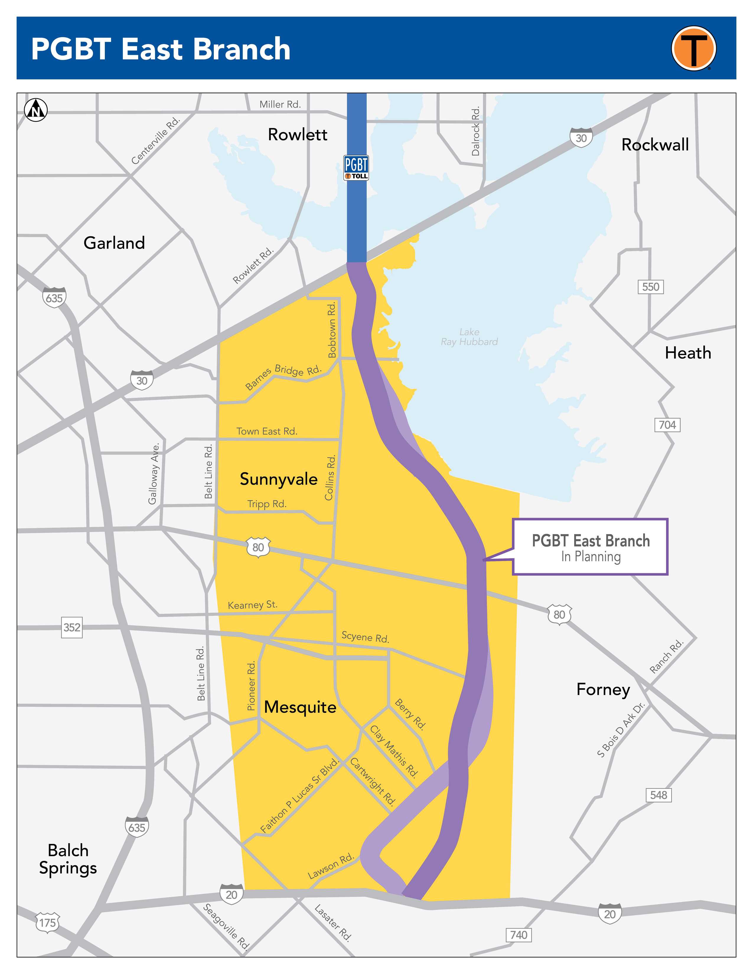
President George Bush Turnpike East Branch
The President George Bush Turnpike (PGBT) East Branch project will extend the PGBT south from I-30 to I-20, approximately 11 miles.
The Texas Department of Transportation (TxDOT) began to study this area in 1969 as part of the Dallas County Outer Loop Project.
In 2021, TxDOT transferred this project to NTTA to complete the environmental study and select a route alignment for the future extension.
Opening date: To be determined.
September 4, 2025 Public Meeting Materials:
NTTA Purchase of Right-of-Way Brochure
NTTA Relocation Assistance (Residential)
NTTA Relocation Assistance (Business, Farm, Non-Profit Organization)
The following information was presented at a Public Meeting held on August 20, 2024:
Additional Public Meeting Materials
Project Sections | Current Stage |
| I-30 to I-20 | In planning |
Recent Progress
• NTTA continues the environmental study to select a route alignment and seek environmental clearance.
• A public meeting was held on August 20, 2024 at the Mesquite Convention Center. Comments were collected from the public.
What's Next?
• A public meeting will be held September 4, 2025 from 5:30 to 7:30 p.m. at the Mesquite Convention Center (1750 Rodeo Dr., Mesquite). Project information will be available for review and public comments will be taken.
• Environmental study and coordination with stakeholders and partners.
Project Information
Email: @email
Public Involvement: (469) 608-6880
Subscribe For Updates